
Terre Haute ZIP Directory Coverage
The local visitor source lists eight mailing codes associated with Terre Haute. That is a postal list, not a map of incorporated land. The Indiana PACE analysis adds county context, including codes with only partial Vigo County shares. USPS remains the authority for the mailing code attached to a full address. No official exact ZIP boundary map, population-by-ZIP table, or local split and realignment history was found in the research.
| ZIP | Area Association | Postal Role | Key Caution |
|---|---|---|---|
| 47801 | Terre Haute mailing list | PO Box use | Not a city-boundary test |
| 47802 | Terre Haute and Vigo County | Street delivery context | Verify the full address |
| 47803 | Terre Haute and Vigo County | Street delivery context | Verify the full address |
| 47804 | North-side local context | Street delivery context | Neighborhood labels are not ZIP lines |
| 47805 | Terre Haute, North Terre Haute, rural alias context | Postal-city layer | Municipal line may differ |
| 47807 | Central Terre Haute context | City mailing code | Confirm by street address |
| 47808 | Terre Haute mailing list | PO Box use | Not a block of homes |
| 47809 | Indiana State University | Institutional association | Do not infer residence |
| 47834, 47842 | Partial Vigo County shares | County overlap | Not every address is Terre Haute |
| 47885 | West Terre Haute | Nearby postal city | Separate place identity |
See the local Terre Haute mailing ZIP list beside its captured source page.

The local list supplies the eight core codes while leaving exact address validation to USPS and jurisdiction checks to local government records.
Verify a Terre Haute ZIP
The USPS ZIP Code Lookup offers three different searches. By Address uses an optional company, then a street address, city, and state. By City and State returns codes tied to a mailing city. Cities by ZIP returns the city and state names associated with a code. The full-address mode is best when the goal is one parcel or person. A city-wide result is broader and may include routes that do not describe a residential block.
| USPS Mode | Fields | Best Use |
|---|---|---|
| By Address | Company optional; street, city, state | Confirm the proper code and mail format |
| By City and State | City and state | See codes linked with Terre Haute as a mailing city |
| Cities by ZIP | ZIP | Check the postal place names tied to one code |
USPS warns that an address result does not prove that a person or company is located there. That limit matters in a ZIP code directory. Use the result to format mail and select the right geographic filter, not to make a current-resident claim.
Find Terre Haute Residents by ZIP
There is no universal Vigo County export of everyone in a ZIP. Instead, use the postal code to narrow a record system that was built for a public task. Beacon may expose location fields in its parcel interface, and the Indiana professional-license and business searches accept ZIP as one filter. The voter status portal is designed for one registrant and requires a name, date of birth, and county rather than an open ZIP-wide resident list.
- Confirm the code through USPS, preferably with the full street address.
- Decide which fact is needed: parcel ownership, civic registration, a business filing, or a public license.
- Enter the ZIP only where the official portal supplies that field. Add a name, street, city, county, or status to reduce false matches.
- Open the record and check its date, jurisdiction, and address type. A mailing address may differ from the site address.
- Once the result narrows to a road, use the Terre Haute street directory for the address-level chain.
A resident search should end when the source does not publish the requested field. Indiana agencies need not create a new list that they do not already keep. A focused records request can seek an existing file, but it should not ask an office to compile a fresh roll of all current residents in a code.
Terre Haute Special ZIP Uses
Three entries show why a ZIP code directory cannot be read as a neighborhood roster. Codes 47801 and 47808 have post-office-box use in the local source. A post-office-box code points to mail boxes, not a polygon of homes. Code 47809 is associated with Indiana State University. An institutional address can identify the destination for campus mail without saying that each person linked to it lives on campus.
That mix is a local geography quirk. The same words, “Terre Haute,” may label a postal city, an institution, a post-office route, or an address beyond the incorporated line. Search results should retain the source's address label. Do not silently convert a business, campus, PO box, or tax mailing address into a home address.
Compare the nonofficial postal-city cross-check with the captured ZIP code directory screen.
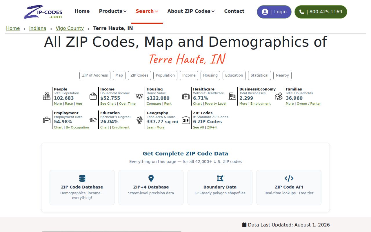
The cross-check helps expose mailing-place variation, but official address decisions still belong to USPS, E911, and the relevant county or city custodian.
Terre Haute ZIP Address Keys
One property can carry several address-like keys. The situs address marks the physical location in assessor and GIS data. The tax mailing address is where correspondence goes. A legal description identifies the land by subdivision, lot and block, or section, township, and range. The ZIP code routes mail. These fields can differ without any error, so compare them instead of choosing one as the whole truth.
- ZIP code
- A postal routing code linked to delivery geography, not a city-limit boundary.
- ZIP+4
- The base code plus four digits that narrow a delivery segment.
- PO-box ZIP
- A code used for mail received through post-office boxes rather than a residential area.
- Unique ZIP
- A code associated with one large institution or high-volume recipient.
- Carrier route
- A postal delivery path that does not serve as a public household roster.
Vigo parcel numbers are separate again. Research examples such as 84-06-34-251-006.000-002 show why a parcel ID should be kept intact and read with the parcel card, legal description, map, and deed. A ZIP filter alone cannot replace those land keys.
Terre Haute ZIP and City Limits
Postal and municipal lines do not share one purpose. USPS assigns mail routes. Terre Haute governs incorporated land. Vigo County administers county records and includes places outside the city. The PACE geographic study lists Vigo codes 47802, 47803, 47804, 47805, 47807, and 47809, plus partial county shares in 47834 and 47842. That is strong evidence of overlap, not a precise boundary map.
Keep the layers separate. A Terre Haute mailing ZIP does not establish Terre Haute municipal residency, and a Vigo County record does not by itself place someone inside the city.
West Terre Haute's 47885 provides a nearby contrast. Its postal identity should not be collapsed into Terre Haute merely because the names and county context are close. Likewise, North Terre Haute or a rural alias tied to 47805 may need a parcel and jurisdiction check. Use the Terre Haute city code, GIS, Assessor, or another official boundary source for municipal questions.
Terre Haute E911 or USPS
Use USPS for mail format and ZIP assignment. Use Vigo County E911 when the question is an emergency-service address, street number, direction, suffix, parcel, or intersection. The county says E911 verifies addresses used for dispatch and maintains routing functions. Its non-emergency lines are available around the clock. Terre Haute Engineering also routes GIS data questions about parcels, sewer, zoning, and related layers.
A useful request states the exact problem. Ask whether an address is valid for dispatch, whether the mailing format is correct, or whether an old street number connects to a modern parcel. Those are different tasks. No official source in the research established a single citywide street-renumbering year, so bridge an old address through adjacent directory years, maps, ordinances, deeds, and E911 or Engineering evidence.
Note: Confirm a GIS layer's update date before treating it as current, since the city GIS request page carries an older update note.
Limits of a Terre Haute ZIP Lookup
ZIP lines and postal associations can change. Yet no verified Terre Haute split or realignment year was found, and the research did not locate an official downloadable boundary map. Do not fill that gap from memory or draw a firm edge from a commercial map. Record the lookup date, save the USPS result, and use a current parcel or government map when the boundary matters.
Population figures also need care. Terre Haute city and Vigo County QuickFacts measure governmental areas, not the individual postal codes in this ZIP code directory. Dividing a city total among codes would invent precision. Likewise, a code shared by city and county land cannot support a city-only count without a sound crosswalk that the source set does not provide.
The safest chain is short: postal code for mail, parcel for land, municipal map for city jurisdiction, and official roll for the record sought. Each source keeps its own date and limits. Together they narrow a search without turning postal geography into an unsupported list of who lives where.
When a code returns no useful match, check the spelling and full address first. Then try the postal city supplied by USPS and compare it with the parcel's county. A failed ZIP filter may reflect the portal's search design, an institutional or PO-box route, or a mismatch between mailing and site addresses. It is not proof that the address or person is absent.